| Magnitude | 5.6 |
| Region | IRAN-PAKISTAN BORDER REGION |
| Date time | 2013-04-17 03:15:54.7 UTC |
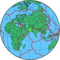
| Location | 28.179 ; 62.344 |
| Depth | 80 km |
| Distance | 196 km NE of Iranshahr, Iran / pop: 131,000 / local time: 07:45:54.7 2013-04-17 111 km E of Khāsh, Iran / pop: 69,600 / local time: 07:45:54.7 2013-04-17 |
All data providers for this event:
National Earthquake Information Center, U.S. Geological Survey -- Golden, United States (NEIC)Geoazur (Universite Cote d'Azur, IRD, CNRS, Observatoire de la Cote d'Azur) -- Nice, France (OCA)
Institute of Geophysics, University of Tehran -- Tehran, Iran (IGUT)
Instituto Geografico Nacional -- Madrid, Spain (IGN)
Landsamt fur Geologie, Rohstoffe und Bergbau -- Freiburg, Germany (LED)
National Institute for Earth Physics -- Bucharest, Romania (NIEP)
Seismological Survey of Serbia -- Belgrade, Serbia (BEO)
Laboratoire de Detection et de Geophysique -- Bruyeres-le-Chatel, France (LDG)
Montenegro Seismological Observatory -- Podgorica, Montenegro (MSO)
GeoForschungsZentrum (GFZ) -- Potsdam, Germany (GFZ)
Norwegian Seismic Array -- Lillestrom, Norway (NORSAR)
International Institute for Earthquake Engineering and Seismology -- Tehran, Iran (IIEES)
Republican Seismic Survey Center or Azerbaijan National Academy of Sciences -- Baku, Azerbaijan (RSSC)
Geophysical Survey of the Russian Academy of Sciences -- Obninsk, Russia (GSRAS)
Further information can be found at:
Institute of Geophysics, University of Tehran -- Tehran, Iran (IGUT)International Institute for Earthquake Engineering and Seismology -- Tehran, Iran (IIEES)
Geophysical Survey of the Russian Academy of Sciences -- Obninsk, Russia (GSRAS)