| Magnitude | 4.7 |
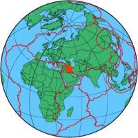
| Region | IRAN-IRAQ BORDER REGION |
| Date time | 2013-11-24 18:03:11.7 UTC |
| Location | 33.949 ; 45.673 |
| Depth | 10 km |
| Distance | 77 km WNW of Īlām, Iran / pop: 140,000 / local time: 21:33:11.7 2013-11-24 25 km NNE of Mandalī, Iraq / pop: 29,700 / local time: 21:03:11.7 2013-11-24 |
All data providers for this event:
National Institute for Earth Physics -- Bucharest, Romania (NIEP)Seismological Survey of Serbia -- Belgrade, Serbia (BEO)
Laboratoire de Detection et de Geophysique -- Bruyeres-le-Chatel, France (LDG)
Montenegro Seismological Observatory -- Podgorica, Montenegro (MSO)
GeoForschungsZentrum (GFZ) -- Potsdam, Germany (GFZ)
Norwegian Seismic Array -- Lillestrom, Norway (NORSAR)
Republican Seismic Survey Center or Azerbaijan National Academy of Sciences -- Baku, Azerbaijan (RSSC)
Geophysical Survey of the Russian Academy of Sciences -- Obninsk, Russia (GSRAS)
Iraqi Meteorological Organisation and Seismology, Seismological Department -- Baghdad, Iraq (ISN)
Bundesanstalt fur Geowissenschaften und Rohstoffe, German Regional Seismograph Network -- Hannover, Germany (BGR)
National Earthquake Information Center, U.S. Geological Survey -- Golden, United States (NEIC)
GeoSphere Austria -- Vienna, Austria (GSA)
Institute of Geophysics, University of Tehran -- Tehran, Iran (IGUT)
Further information can be found at:
International Institute for Earthquake Engineering and Seismology -- Tehran, Iran (IIEES)Institute of Geophysics, University of Tehran -- Tehran, Iran (IGUT)
Geophysical Survey of the Russian Academy of Sciences -- Obninsk, Russia (GSRAS)