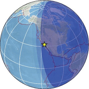
| Magnitude | 2.0 |
| Region | BAJA CALIFORNIA, MEXICO |
| Date time | 2026-02-17 02:45:03.7 UTC |
| Location | 32.637 ; -115.730 |
| Depth | 6 km |
| Distance | 26 km W of Mexicali, Mexico / pop: 689,000 / local time: 18:45:03.7 2026-02-16 23 km SSW of El Centro, United States / pop: 43,900 / local time: 18:45:03.7 2026-02-16 |
Source parameters provided by:
Southern California Seismic Network, California Institute of Technology / USGS - Pasadena -- Pasadena, United States (SCSN)
All data providers for this event:
Southern California Seismic Network, California Institute of Technology / USGS - Pasadena -- Pasadena, United States (SCSN)Further information can be found at:
GeoForschungsZentrum (GFZ) -- Potsdam, Germany (GFZ)National Earthquake Information Center, U.S. Geological Survey -- Golden, United States (NEIC)