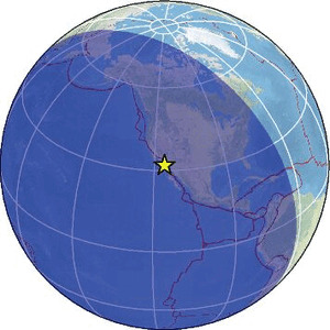
| Magnitude | 2.3 |
| Region | BAJA CALIFORNIA, MEXICO |
| Date time | 2026-03-31 09:58:01.0 UTC |
| Location | 31.831 ; -115.837 |
| Depth | 11 km |
| Distance | 72 km E of Ensenada, Mexico / pop: 279,000 / local time: 02:58:01.0 2026-03-31 41 km E of Fraccionamiento del Valle, Mexico / pop: 1,000 / local time: 02:58:01.0 2026-03-31 |
Source parameters provided by:
National Earthquake Information Center, U.S. Geological Survey -- Golden, United States (NEIC)
All data providers for this event:
Southern California Seismic Network, California Institute of Technology / USGS - Pasadena -- Pasadena, United States (SCSN)National Earthquake Information Center, U.S. Geological Survey -- Golden, United States (NEIC)
Further information can be found at:
Servicio Sismologico Nacional, Instituto de Geofisica, UNAM -- Mexico City, Mexico (UNM)National Earthquake Information Center, U.S. Geological Survey -- Golden, United States (NEIC)
GeoForschungsZentrum (GFZ) -- Potsdam, Germany (GFZ)