| Magnitude | 4.4 |
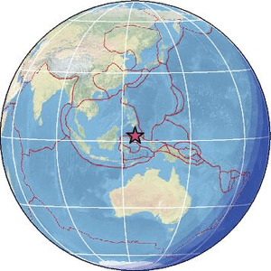
| Region | KEPULAUAN SANGIHE, INDONESIA |
| Date time | 2026-06-21 06:18:21.1 UTC |
| Location | 2.259 ; 125.630 |
| Depth | 133 km |
| Distance | 123 km NE of Manado, Indonesia / pop: 451,000 / local time: 14:18:21.1 2026-06-21 113 km NNE of Laikit, Laikit II (Dimembe), Indonesia / pop: 8,000 / local time: 14:18:21.1 2026-06-21 |
Source parameters provided by:
National Earthquake Information Center, U.S. Geological Survey -- Golden, United States (NEIC)
All data providers for this event:
Badan Meteorologi, Klimatologi dan Geofisika -- Jakarta, Indonesia (BMKG)GeoForschungsZentrum (GFZ) -- Potsdam, Germany (GFZ)
National Earthquake Information Center, U.S. Geological Survey -- Golden, United States (NEIC)
Philippine Inst. of Volcanology and Seismology, Quezon City, Philippines -- Manila, Philippines (PIVS)
Further information can be found at:
Philippine Inst. of Volcanology and Seismology, Quezon City, Philippines -- Manila, Philippines (PIVS)Badan Meteorologi, Klimatologi dan Geofisika -- Jakarta, Indonesia (BMKG)
GeoForschungsZentrum (GFZ) -- Potsdam, Germany (GFZ)
National Earthquake Information Center, U.S. Geological Survey -- Golden, United States (NEIC)