| Magnitude | 4.7 |
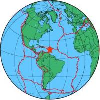
| Region | EAST OF DOMINICA, LEEWARD ISL. |
| Date time | 2011-04-10 23:44:02.3 UTC |
| Location | 15.382 ; -59.804 |
| Depth | 10 km |
| Distance | 162 km NE of Fort-de-France, Martinique / pop: 89,900 / local time: 19:44:02.3 2011-04-10 145 km NE of Le Robert, Martinique / pop: 23,800 / local time: 19:44:02.3 2011-04-10 |
All data providers for this event:
National Earthquake Information Center, U.S. Geological Survey -- Golden, United States (NEIC)Further information can be found at:
University of the West Indies, St. Augustine, Trinidad -- Saint Augustine, Trinidad and Tobago (TRN)National Earthquake Information Center, U.S. Geological Survey -- Golden, United States (NEIC)
Observatoire Volcanologique et Sismologique de Martinique (OVSM - IPGP) -- Martinique, Martinique (OVSM)
Observatoire Volcanologique du Piton de la Fournaise (OVPF - IPGP) -- La Plaine des Cafres, Reunion (OVPF)
GeoForschungsZentrum (GFZ) -- Potsdam, Germany (GFZ)