| Magnitude | 6.9 |
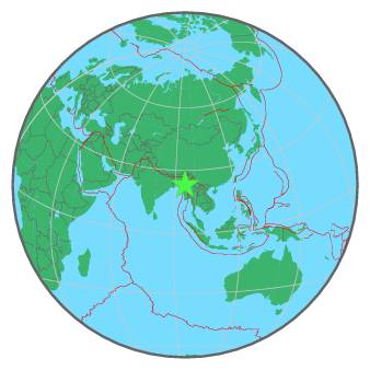
| Region | MYANMAR |
| Date time | 2016-04-13 13:55:17.7 UTC |
| Location | 23.135 ; 94.932 |
| Depth | 137 km |
| Distance | 116 km NNW of Monywa, Myanmar / pop: 182,000 / local time: 20:25:17.7 2016-04-13 78 km SE of Mawlaik, Myanmar / pop: 44,500 / local time: 20:25:17.7 2016-04-13 |
All data providers for this event:
Geoscience Australia, Canberra, ACT, Australia -- Canberra, Australia (AUST)British Geological Survey -- Edinburgh, United Kingdom (BGS)
GeoForschungsZentrum (GFZ) -- Potsdam, Germany (GFZ)
Inst. de Astron., Geof. e Ciencias Atmos., Univ. de S?o Paulo, Brazil -- , Brazil (VAO)
Republican Seismic Survey Center or Azerbaijan National Academy of Sciences -- Baku, Azerbaijan (RSSC)
National Earthquake Information Center, U.S. Geological Survey -- Golden, United States (NEIC)
Instituto Geografico Nacional -- Madrid, Spain (IGN)
National Institute for Earth Physics -- Bucharest, Romania (NIEP)
Laboratoire de Detection et de Geophysique -- Bruyeres-le-Chatel, France (LDG)
HUN-REN EPSS Kövesligethy Radó Seismological Observato -- Budapest, Hungary (BUD)
Geophysical Survey of the Russian Academy of Sciences -- Obninsk, Russia (GSRAS)
Kandilli Observatory and Earthquake Research Institute -- Istanbul, Türkiye (KOERI)
Instituto Nazionale di Geofisica e Vulcanologia -- Rome, Italy (INGV) -- DOI: https://terremoti.ingv.it/en/iside
Further information can be found at:
National Earthquake Information Center, U.S. Geological Survey -- Golden, United States (NEIC)GeoForschungsZentrum (GFZ) -- Potsdam, Germany (GFZ)