| Magnitude | 3.2 |
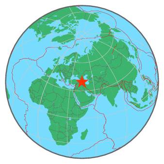
| Region | TURKEY-IRAN BORDER REGION |
| Date time | 2016-08-19 17:42:51.8 UTC |
| Location | 39.533 ; 44.710 |
| Depth | 2 km |
| Distance | 74 km SSE of Yerevan, Armenia / pop: 1,093,000 / local time: 21:42:51.8 2016-08-19 33 km SSE of Ararat, Armenia / pop: 28,800 / local time: 21:42:51.8 2016-08-19 |
All data providers for this event:
Republican Seismic Survey Center or Azerbaijan National Academy of Sciences -- Baku, Azerbaijan (RSSC)National Survey of Seismic Protection -- Yerevan, Armenia (NSSP)
Kandilli Observatory and Earthquake Research Institute -- Istanbul, Turkey (KOERI)
Institute of Geophysics, University of Tehran -- Tehran, Iran (IGUT)
Further information can be found at:
Geophysical Survey of the Russian Academy of Sciences -- Obninsk, Russia (GSRAS)Kandilli Observatory and Earthquake Research Institute -- Istanbul, Turkey (KOERI)
Disaster and Emergency Management Presidency, Earthquake Department (AFAD) -- Ankara, Turkey (AFAD)
International Institute for Earthquake Engineering and Seismology -- Tehran, Iran (IIEES)
Institute of Geophysics, University of Tehran -- Tehran, Iran (IGUT)