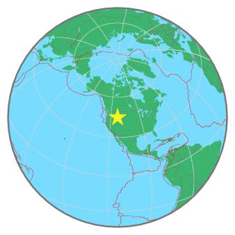
| Magnitude | 2.0 |
| Region | WESTERN MONTANA |
| Date time | 2021-12-01 12:18:43.9 UTC |
| Location | 44.986 ; -113.036 |
| Depth | 4 km |
| Distance | 295 km NE of Boise, United States / pop: 145,000 / local time: 05:18:43.9 2021-12-01 40 km SW of Dillon, United States / pop: 4,200 / local time: 05:18:43.9 2021-12-01 |
All data providers for this event:
Montana Regional Seismic Network, Montana Bureau of Mines and Geology -- Helena, United States (MB)Further information can be found at:
National Earthquake Information Center, U.S. Geological Survey -- Golden, United States (NEIC)GeoForschungsZentrum (GFZ) -- Potsdam, Germany (GFZ)