| Magnitude | 4.6 |
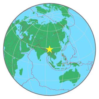
| Region | MYANMAR-INDIA BORDER REGION |
| Date time | 2021-12-21 05:04:14.7 UTC |
| Location | 27.552 ; 97.002 |
| Depth | 35 km |
| Distance | 207 km ENE of Dibrugarh, India / pop: 122,000 / local time: 10:34:14.7 2021-12-21 73 km SE of Hayuliang, India / pop: 1,800 / local time: 10:34:14.7 2021-12-21 |
All data providers for this event:
GeoForschungsZentrum (GFZ) -- Potsdam, Germany (GFZ)Geophysical Survey of the Russian Academy of Sciences -- Obninsk, Russia (GSRAS)
National Earthquake Information Center, U.S. Geological Survey -- Golden, United States (NEIC)
India Meteorological Department, New Delhi, India -- New Delhi, India (NDI)
Further information can be found at:
GeoForschungsZentrum (GFZ) -- Potsdam, Germany (GFZ)India Meteorological Department, New Delhi, India -- New Delhi, India (NDI)
Geophysical Survey of the Russian Academy of Sciences -- Obninsk, Russia (GSRAS)
National Earthquake Information Center, U.S. Geological Survey -- Golden, United States (NEIC)