| Magnitude | 5.4 |
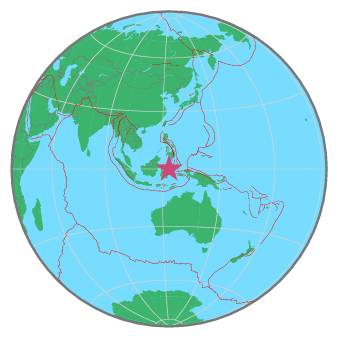
| Region | MINAHASA, SULAWESI, INDONESIA |
| Date time | 2021-12-26 15:01:31.1 UTC |
| Location | 0.071 ; 123.433 |
| Depth | 113 km |
| Distance | 222 km SW of Manado, Indonesia / pop: 451,000 / local time: 23:01:31.1 2021-12-26 66 km SE of Gorontalo, Indonesia / pop: 144,000 / local time: 23:01:31.1 2021-12-26 |
All data providers for this event:
Geoscience Australia, Canberra, ACT, Australia -- Canberra, Australia (AUST)Centro de Sismologia da Universidade de Sao Paulo (member of the RSBR) -- Sao Paulo, Brazil (USP)
GeoForschungsZentrum (GFZ) -- Potsdam, Germany (GFZ)
Republican Seismic Survey Center or Azerbaijan National Academy of Sciences -- Baku, Azerbaijan (RSSC)
Instituto Portugues do Mar e da Atmosfera -- Lisbon, Portugal (IPMA)
Geonet, GNS science -- Lower Hutt, New Zealand (GNS)
National Earthquake Information Center, U.S. Geological Survey -- Golden, United States (NEIC)
Universidad de Panama -- Panama, Panama (IGC)
National Institute for Earth Physics -- Bucharest, Romania (NIEP)
Ukrainian NDC, Main Center of Special Monitoring -- Kyiv, Ukraine (MCSM)
HUN-REN EPSS Kövesligethy Radó Seismological Observato -- Budapest, Hungary (BUD)
Badan Meteorologi, Klimatologi dan Geofisika -- Jakarta, Indonesia (BMKG)
Geophysical Survey of the Russian Academy of Sciences -- Obninsk, Russia (GSRAS)
Kandilli Observatory and Earthquake Research Institute -- Istanbul, Türkiye (KOERI)
Further information can be found at:
Philippine Inst. of Volcanology and Seismology, Quezon City, Philippines -- Manila, Philippines (PIVS)GeoForschungsZentrum (GFZ) -- Potsdam, Germany (GFZ)
Badan Meteorologi, Klimatologi dan Geofisika -- Jakarta, Indonesia (BMKG)
National Earthquake Information Center, U.S. Geological Survey -- Golden, United States (NEIC)