| Magnitude | 5.1 |
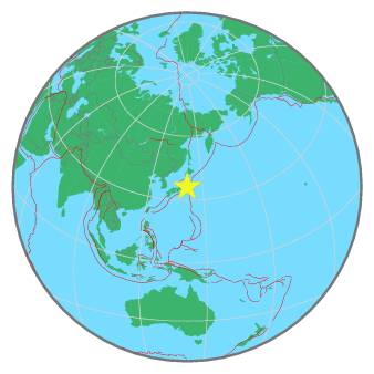
| Region | NEAR EAST COAST OF HONSHU, JAPAN |
| Date time | 2022-08-06 12:23:48.6 UTC |
| Location | 36.242 ; 141.084 |
| Depth | 29 km |
| Distance | 58 km E of Mito, Japan / pop: 246,000 / local time: 21:23:48.6 2022-08-06 56 km SE of Hitachi, Japan / pop: 186,000 / local time: 21:23:48.6 2022-08-06 |
All data providers for this event:
National Institute for Earth Physics -- Bucharest, Romania (NIEP)Geoscience Australia, Canberra, ACT, Australia -- Canberra, Australia (AUST)
Japan Meteorological Agency Seismic Network -- Tokyo, Japan (JMA)
Ukrainian NDC, Main Center of Special Monitoring -- Kyiv, Ukraine (MCSM)
Seismological Survey of Serbia -- Belgrade, Serbia (BEO)
GeoForschungsZentrum (GFZ) -- Potsdam, Germany (GFZ)
Republican Seismic Survey Center or Azerbaijan National Academy of Sciences -- Baku, Azerbaijan (RSSC)
Badan Meteorologi, Klimatologi dan Geofisika -- Jakarta, Indonesia (BMKG)
Geophysical Survey of the Russian Academy of Sciences -- Obninsk, Russia (GSRAS)
Kandilli Observatory and Earthquake Research Institute -- Istanbul, Türkiye (KOERI)
National Earthquake Information Center, U.S. Geological Survey -- Golden, United States (NEIC)
Further information can be found at:
Japan Meteorological Agency Seismic Network -- Tokyo, Japan (JMA)GeoForschungsZentrum (GFZ) -- Potsdam, Germany (GFZ)
National Earthquake Information Center, U.S. Geological Survey -- Golden, United States (NEIC)