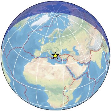
98 km SE of Elbasan, Albania / pop: 100,000 / local time: 11:59:41.4 2023-03-24
12 km NE of Ersekë, Albania / pop: 7,800 / local time: 11:59:41.4 2023-03-24
For more information on computation, see the article Bossu et al., 2016:
Thumbnail Based Questionnaires for the Rapid and Efficient Collection of Macroseismic Data from Global Earthquakes, Rémy Bossu, Matthieu Landès, Fréderic Roussel, Robert Steed, Gilles Mazet-Roux, Stacey S. Martin, and Susan Hough. Seismological Research Letter. Oct 2016. doi: 10.1785/0220160120;
Furthermore, to avoid the association with wrong events, we filter testimonies in distance and in intensity depending on the magnitude of the seismic event.
References for tectonic plate boundaries:
Coffin, M.F., Gahagan, L.M., and Lawver, L.A., 1998, Present-day Plate Boundary Digital Data Compilation. University of Texas Institute for Geophysics Technical Report No. 174, pp. 5.
Maps view: Seismicity from the previous 7 days in the area .
Regional instrumental seismicity
This seismicity maps have been generated by concatenating the ISC catalogue (since 1964), the EMSC Euro-Med Bulletin catalogue and the EMSC Real Time catalogue. Therefore, they show the seismicity from 1964 until the earthquake occurrence.
Regional deadly earthquakes from 1500 to origin time
Date
Long.
Lat.
Mag.
Death
Location
1544-04-22
22.6
38.8
6.8
many
GREECE
1566-07-11
21.7
39.0
6.5
many
GREECE
1674-01-01
20.0
39.5
6.5
200
GREECE-ALBANIA BORDER REGION
1701-03-19
19.8
40.2
6.4
300
ALBANIA
1704-11-22
20.7
38.7
6.6
34
GREECE
1723-02-22
20.7
38.6
7.0
many
GREECE
1743-02-20
18.8
39.9
7.3
180
SOUTHERN ITALY
1759-06-22
23.1
40.7
6.5
many
GREECE
1783-03-23
20.5
38.6
7.0
35
GREECE
1786-02-05
19.9
39.6
6.6
126
GREECE-ALBANIA BORDER REGION
1825-01-19
20.7
38.8
6.8
58
GREECE
1851-10-12
19.7
40.7
6.6
2000
ALBANIA
1851-10-17
20.0
40.7
?
400
GREECE-ALBANIA BORDER REGION
1854-07-30
20.2
39.9
6.4
many
GREECE-ALBANIA BORDER REGION
1866-01-02
19.5
40.4
6.5
60
ALBANIA
1894-04-20
23.0
38.6
6.7
255
GREECE
1894-04-27
23.0
38.7
7.2
255
GREECE
1895-05-14
20.5
39.4
6.6
many
GREECE-ALBANIA BORDER REGION
1905-06-01
19.5
42.1
6.6
120
ALBANIA-SERBIA-MONTENEGRO BORDER
1909-06-15
22.2
39.1
5.7
36
GREECE
1920-11-26
20.0
40.3
6.3
200
GREECE-ALBANIA BORDER REGION
1930-11-21
19.6
40.2
6.0
35
ALBANIA
1930-12-02
19.6
40.3
5.0
25
ALBANIA
1931-01-28
20.7
40.6
5.9
100
GREECE-ALBANIA BORDER REGION
1931-03-08
22.5
41.3
6.7
35
FYR OF MACEDONIA REGION
1942-08-27
20.4
41.6
5.9
43
ALBANIA-FYR OF MACEDONIA BDR REG
1954-04-30
22.3
39.3
7.0
31
GREECE
1963-07-26
21.4
42.0
6.1
1070
SERBIA-FYR OF MACEDONIA BORD REG
1979-04-15
19.2
42.1
6.9
129
ALBANIA-SERBIA-MONTENEGRO BORDER
2015-11-17
20.4
38.8
6.5
2
GREECE
2019-11-26
19.5
41.4
6.4
51
ALBANIA
Source:
From 1500 to 1999: T. Utsu ; International Handbook of Earthquake and Engineering Seismology; vol. A; 691-718