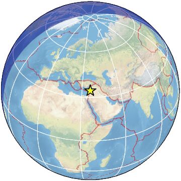
53 km SSW of Homs, Syria / pop: 775,000 / local time: 11:46:15.8 2023-03-25
26 km SSW of Al QuÅŸayr, Syria / pop: 41,000 / local time: 11:46:15.8 2023-03-25
For more information on computation, see the article Bossu et al., 2016:
Thumbnail Based Questionnaires for the Rapid and Efficient Collection of Macroseismic Data from Global Earthquakes, Rémy Bossu, Matthieu Landès, Fréderic Roussel, Robert Steed, Gilles Mazet-Roux, Stacey S. Martin, and Susan Hough. Seismological Research Letter. Oct 2016. doi: 10.1785/0220160120;
Furthermore, to avoid the association with wrong events, we filter testimonies in distance and in intensity depending on the magnitude of the seismic event.
References for tectonic plate boundaries:
Coffin, M.F., Gahagan, L.M., and Lawver, L.A., 1998, Present-day Plate Boundary Digital Data Compilation. University of Texas Institute for Geophysics Technical Report No. 174, pp. 5.
Maps view: Seismicity from the previous 7 days in the area .
Regional instrumental seismicity
This seismicity maps have been generated by concatenating the ISC catalogue (since 1964), the EMSC Euro-Med Bulletin catalogue and the EMSC Real Time catalogue. Therefore, they show the seismicity from 1964 until the earthquake occurrence.
Regional deadly earthquakes from 1500 to origin time
Date
Long.
Lat.
Mag.
Death
Location
1407-04-00
36.0
36.0
?
100
TURKEY-SYRIA BORDER REGION
1408-12-20
36.8
35.1
?
many
SYRIA
1752-07-21
35.5
35.5
7.0
20000
NEAR THE COAST OF SYRIA
1759-10-30
35.6
33.1
6.6
2000
LEBANON - SYRIA REGION
1759-11-25
35.9
33.7
7.4
30000
LEBANON - SYRIA REGION
1796-04-26
36.0
35.7
6.6
1500
SYRIA
1822-09-05
36.0
35.0
?
22000
SYRIA
1837-01-01
35.5
33.0
7.0
5700
LEBANON - SYRIA REGION
1956-03-16
35.5
35.6
6.0
148
NEAR THE COAST OF SYRIA
Source:
From 1500 to 1999: T. Utsu ; International Handbook of Earthquake and Engineering Seismology; vol. A; 691-718