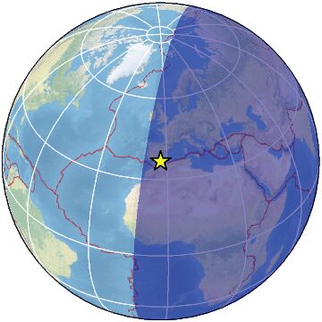
47 km SW of AlmerÃa, Spain / pop: 188,000 / local time: 21:05:02.9 2023-03-26
21 km S of El Ejido, Spain / pop: 84,700 / local time: 21:05:02.9 2023-03-26
For more information on computation, see the article Bossu et al., 2016:
Thumbnail Based Questionnaires for the Rapid and Efficient Collection of Macroseismic Data from Global Earthquakes, Rémy Bossu, Matthieu Landès, Fréderic Roussel, Robert Steed, Gilles Mazet-Roux, Stacey S. Martin, and Susan Hough. Seismological Research Letter. Oct 2016. doi: 10.1785/0220160120;
Furthermore, to avoid the association with wrong events, we filter testimonies in distance and in intensity depending on the magnitude of the seismic event.
References for tectonic plate boundaries:
Coffin, M.F., Gahagan, L.M., and Lawver, L.A., 1998, Present-day Plate Boundary Digital Data Compilation. University of Texas Institute for Geophysics Technical Report No. 174, pp. 5.
Maps view: Seismicity from the previous 7 days in the area .
Regional instrumental seismicity
This seismicity maps have been generated by concatenating the ISC catalogue (since 1964), the EMSC Euro-Med Bulletin catalogue and the EMSC Real Time catalogue. Therefore, they show the seismicity from 1964 until the earthquake occurrence.
Regional deadly earthquakes from 1500 to origin time
Date
Long.
Lat.
Mag.
Death
Location
1518-11-09
-1.5
37.2
?
many
SPAIN
1522-09-21
-2.3
36.5
?
many
STRAIT OF GIBRALTAR
1680-10-09
-4.4
36.5
?
70
STRAIT OF GIBRALTAR
1804-08-25
-2.4
36.9
?
162
STRAIT OF GIBRALTAR
1829-03-21
-0.9
38.2
7.0
839
SPAIN
1884-12-25
-4.0
37.0
6.8
745
SPAIN
2004-02-24
-4.0
35.2
6.3
631
STRAIT OF GIBRALTAR
2008-06-06
-0.7
35.9
5.6
1
NORTHERN ALGERIA
2011-05-11
-1.7
37.7
5.1
10
SPAIN
2016-01-25
-3.7
35.7
6.3
1
STRAIT OF GIBRALTAR
Source:
From 1500 to 1999: T. Utsu ; International Handbook of Earthquake and Engineering Seismology; vol. A; 691-718