| Magnitude | 4.5 |
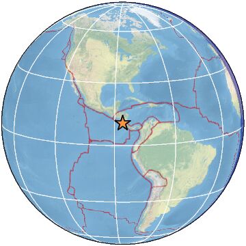
| Region | OFF COAST OF COSTA RICA |
| Date time | 2023-03-29 18:49:11.4 UTC |
| Location | 10.600 ; -86.088 |
| Depth | 45 km |
| Distance | 153 km S of Masaya, Nicaragua / pop: 130,000 / local time: 12:49:11.4 2023-03-29 49 km W of Sardinal, Costa Rica / pop: 3,200 / local time: 12:49:11.4 2023-03-29 |
All data providers for this event:
GeoForschungsZentrum (GFZ) -- Potsdam, Germany (GFZ)Instituto Nicaraguense de Estudios Territoriales -- Managua, Nicaragua (INET)
Seccion de Sismologia, Univ. de Costa Rica, San Jose, Costa Rica -- San Jose, Costa Rica (UCR)
National Earthquake Information Center, U.S. Geological Survey -- Golden, United States (NEIC)
Further information can be found at:
GeoForschungsZentrum (GFZ) -- Potsdam, Germany (GFZ)National Earthquake Information Center, U.S. Geological Survey -- Golden, United States (NEIC)
Seccion de Sismologia, Univ. de Costa Rica, San Jose, Costa Rica -- San Jose, Costa Rica (UCR)
Servicio Sismologico Nacional, Instituto de Geofisica, UNAM -- Mexico City, Mexico (UNM)