| Magnitude | 5.5 |
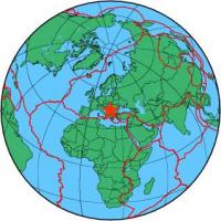
| Region | SERBIA |
| Date time | 2010-11-03 00:56:55.4 UTC |
| Location | 43.760 ; 20.730 |
| Depth | 1 km |
| Distance | 32 km SSW of Kragujevac, Serbia / pop: 147,000 / local time: 01:56:55.4 2010-11-03 5 km NNE of Kraljevo, Serbia / pop: 82,800 / local time: 01:56:55.4 2010-11-03 |
All data providers for this event:
Landsamt fur Geologie, Rohstoffe und Bergbau -- Freiburg, Germany (LED)Seismological Survey of Serbia -- Belgrade, Serbia (BEO)
Geophysical Institute of the Academy of Sciences -- Prague, Czech Republic (GFU)
Montenegro Seismological Observatory -- Podgorica, Montenegro (MSO)
GeoForschungsZentrum (GFZ) -- Potsdam, Germany (GFZ)
National Institute in Geophysics, Geodesy and Geography - BAS -- Sofia, Bulgaria (SOF)
Republican Seismic Survey Center or Azerbaijan National Academy of Sciences -- Baku, Azerbaijan (RSSC)
Bundesanstalt fur Geowissenschaften und Rohstoffe, German Regional Seismograph Network -- Hannover, Germany (BGR)
National Earthquake Information Center, U.S. Geological Survey -- Golden, United States (NEIC)
GeoSphere Austria -- Vienna, Austria (GSA)
Instituto Geografico Nacional -- Madrid, Spain (IGN)
Slovenian Environment Agency, Seismology Office -- Ljubljana, Slovenia (ARSO)
National Institute for Earth Physics -- Bucharest, Romania (NIEP)
Institute of Geosciences, Polytechnic University of Tirana -- Tirana, Albania (IGEO)
Laboratoire de Detection et de Geophysique -- Bruyeres-le-Chatel, France (LDG)
Geophysical Institute, Seismology Division, Slovak Academy of Sciences -- Bratislava, Slovakia (BRA)
Geophysical Survey of the Russian Academy of Sciences -- Obninsk, Russia (GSRAS)
Kandilli Observatory and Earthquake Research Institute -- Istanbul, Turkey (KOERI)
Seismological Observatory -- Skopje, North Macedonia, Republic of (SKO)
Further information can be found at:
Seismological Survey of Serbia -- Belgrade, Serbia (BEO)