| Magnitude | 4.5 |
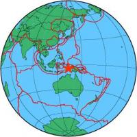
| Region | NEAR S COAST OF PAPUA, INDONESIA |
| Date time | 2013-11-27 12:08:30.2 UTC |
| Location | -4.780 ; 133.860 |
| Depth | 10 km |
| Distance | 521 km SE of Sorong, Indonesia / pop: 125,000 / local time: 21:08:30.2 2013-11-27 155 km NE of Tual, Indonesia / pop: 39,500 / local time: 21:08:30.2 2013-11-27 |
All data providers for this event:
GeoForschungsZentrum (GFZ) -- Potsdam, Germany (GFZ)Further information can be found at:
Badan Meteorologi, Klimatologi dan Geofisika -- Jakarta, Indonesia (BMKG)National Earthquake Information Center, U.S. Geological Survey -- Golden, United States (NEIC)
GeoForschungsZentrum (GFZ) -- Potsdam, Germany (GFZ)