| Magnitude | 5.4 |
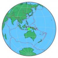
| Region | KEPULAUAN BABAR, INDONESIA |
| Date time | 2015-05-12 07:22:04.8 UTC |
| Location | -7.338 ; 129.271 |
| Depth | 149 km |
| Distance | 422 km SSE of Ambon, Indonesia / pop: 355,000 / local time: 16:22:04.8 2015-05-12 283 km NE of Lospalos, Timor Leste / pop: 17,100 / local time: 16:22:04.8 2015-05-12 |
All data providers for this event:
GeoForschungsZentrum (GFZ) -- Potsdam, Germany (GFZ)British Geological Survey (Global Network) -- Edinburgh, United Kingdom (BGSG)
Geophysical Survey of the Russian Academy of Sciences -- Obninsk, Russia (GSRAS)
National Earthquake Information Center, U.S. Geological Survey -- Golden, United States (NEIC)
Further information can be found at:
GeoForschungsZentrum (GFZ) -- Potsdam, Germany (GFZ)Badan Meteorologi, Klimatologi dan Geofisika -- Jakarta, Indonesia (BMKG)
National Earthquake Information Center, U.S. Geological Survey -- Golden, United States (NEIC)