| Magnitude | 7.0 |
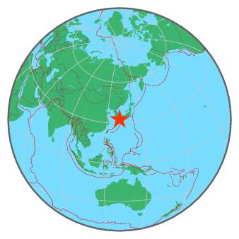
| Region | KYUSHU, JAPAN |
| Date time | 2016-04-15 16:25:06.5 UTC |
| Location | 32.783 ; 130.683 |
| Depth | 10 km |
| Distance | 94 km SSE of Fukuoka, Japan / pop: 1,392,000 / local time: 01:25:06.5 2016-04-16 3 km S of Kumamoto, Japan / pop: 680,000 / local time: 01:25:06.5 2016-04-16 |
All data providers for this event:
Instituto Geografico Nacional -- Madrid, Spain (IGN)Geoscience Australia, Canberra, ACT, Australia -- Canberra, Australia (AUST)
Japan Meteorological Agency Seismic Network -- Tokyo, Japan (JMA)
GeoForschungsZentrum (GFZ) -- Potsdam, Germany (GFZ)
Inst. de Astron., Geof. e Ciencias Atmos., Univ. de S?o Paulo, Brazil -- , Brazil (VAO)
Alaska Tsunami Warning Seismic System, West Coast and Alaska Tsunami Warning Center -- Anchorage, United States (AT)
HUN-REN EPSS Kövesligethy Radó Seismological Observato -- Budapest, Hungary (BUD)
Republican Seismic Survey Center or Azerbaijan National Academy of Sciences -- Baku, Azerbaijan (RSSC)
Geophysical Survey of the Russian Academy of Sciences -- Obninsk, Russia (GSRAS)
Kandilli Observatory and Earthquake Research Institute -- Istanbul, Turkey (KOERI)
National Earthquake Information Center, U.S. Geological Survey -- Golden, United States (NEIC)
Pacific Tsunami Warning Center -- Honolulu, United States (PTWC)
Further information can be found at:
GeoForschungsZentrum (GFZ) -- Potsdam, Germany (GFZ)Japan Meteorological Agency Seismic Network -- Tokyo, Japan (JMA)
National Earthquake Information Center, U.S. Geological Survey -- Golden, United States (NEIC)