| Magnitude | 2.1 |
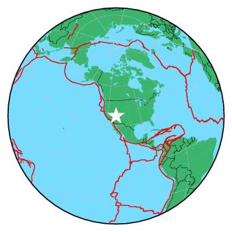
| Region | UTAH |
| Date time | 2016-12-12 07:11:41.8 UTC |
| Location | 37.553 ; -112.447 |
| Depth | 0 km |
| Distance | 277 km NE of Sunrise Manor, United States / pop: 189,000 / local time: 23:11:41.8 2016-12-11 30 km S of Panguitch, United States / pop: 1,400 / local time: 00:11:41.8 2016-12-12 |
All data providers for this event:
University of Utah Regional Network, University of Utah Seismograph Stations -- Salt Lake City, United States (UU)Further information can be found at:
GeoForschungsZentrum (GFZ) -- Potsdam, Germany (GFZ)National Earthquake Information Center, U.S. Geological Survey -- Golden, United States (NEIC)