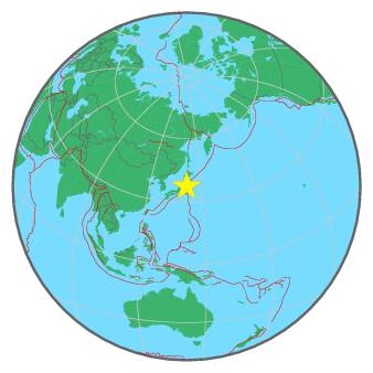
tempDisclaimer
M 5.3 - NEAR EAST COAST OF HONSHU, JAPAN - 2017-03-11 19:57:48 UTC
I felt this earthquake
Summary | Maps | Testimonies | Pictures | List of data providers | Scientific data |
| ![]() |
More information at: |
Earthquake View | Interactive Maps View | I felt this earthquake | Contribution Map |
Seismicity | Regional Moment tensors | Quick MT solutions | PGA/PGV/Population |
Int_Dist | Dist_Time | Donut |
No enough data for Intensity/Distance curve
For more information on computation, see the article Bossu et al., 2016:
- Thumbnail Based Questionnaires for the Rapid and Efficient Collection of Macroseismic Data from Global Earthquakes, Rémy Bossu, Matthieu Landès, Fréderic Roussel, Robert Steed, Gilles Mazet-Roux, Stacey S. Martin, and Susan Hough. Seismological Research Letter. Oct 2016. doi: 10.1785/0220160120;
- Furthermore, to avoid the association with wrong events, we filter testimonies in distance and in intensity depending on the magnitude of the seismic event.
Global view | Regional view | Local view |
References for tectonic plate boundaries:
Coffin, M.F., Gahagan, L.M., and Lawver, L.A., 1998, Present-day Plate Boundary Digital Data Compilation. University of Texas Institute for Geophysics Technical Report No. 174, pp. 5.
Maps view: Seismicity from the previous 7 days in the area |
This seismicity maps have been generated by concatenating the ISC catalogue (since 1964), the EMSC Euro-Med Bulletin catalogue and the EMSC Real Time catalogue. Therefore, they show the seismicity from 1964 until the earthquake occurrence.
Date | Long. | Lat. | Mag. | Death | Location |
1502-01-18 | 138.2 | 37.2 | 6.8 | many | NEAR WEST COAST OF HONSHU, JAPAN |
1611-09-27 | 139.8 | 37.6 | 6.9 | 3700 | EASTERN HONSHU, JAPAN |
1611-12-02 | 144.0 | 39.0 | 8.1 | 5000 | OFF EAST COAST OF HONSHU, JAPAN |
1615-06-26 | 139.7 | 35.7 | 6.5 | many | NEAR S. COAST OF HONSHU, JAPAN |
1644-10-18 | 140.0 | 39.4 | 6.5 | 63 | EASTERN HONSHU, JAPAN |
1649-07-30 | 139.5 | 35.8 | 7.0 | many | NEAR S. COAST OF HONSHU, JAPAN |
1659-04-21 | 139.8 | 37.1 | 6.9 | 50 | EASTERN HONSHU, JAPAN |
1666-02-01 | 138.2 | 37.1 | 6.8 | 1500 | NEAR WEST COAST OF HONSHU, JAPAN |
1677-11-04 | 141.5 | 35.0 | 8.0 | 540 | NEAR EAST COAST OF HONSHU, JAPAN |
1751-05-21 | 138.2 | 37.1 | 7.2 | 1541 | NEAR WEST COAST OF HONSHU, JAPAN |
1793-02-17 | 144.5 | 38.5 | 8.3 | 720 | OFF EAST COAST OF HONSHU, JAPAN |
1802-12-09 | 138.4 | 37.8 | 6.8 | 37 | NEAR WEST COAST OF HONSHU, JAPAN |
1804-07-10 | 140.0 | 39.1 | 7.0 | 313 | EASTERN HONSHU, JAPAN |
1810-09-25 | 139.9 | 39.9 | 6.5 | 60 | NEAR WEST COAST OF HONSHU, JAPAN |
1812-12-07 | 139.7 | 35.5 | 6.3 | many | NEAR S. COAST OF HONSHU, JAPAN |
1823-09-29 | 141.1 | 40.0 | 5.9 | 73 | NEAR EAST COAST OF HONSHU, JAPAN |
1828-12-18 | 138.9 | 37.6 | 6.9 | 1681 | NEAR WEST COAST OF HONSHU, JAPAN |
1833-12-07 | 139.3 | 38.9 | 7.7 | 100 | NEAR WEST COAST OF HONSHU, JAPAN |
1835-07-20 | 142.5 | 38.5 | 7.0 | many | NEAR EAST COAST OF HONSHU, JAPAN |
1855-11-11 | 139.8 | 35.7 | 6.9 | 7444 | NEAR S. COAST OF HONSHU, JAPAN |
1894-06-20 | 140.1 | 35.6 | 6.6 | 31 | NEAR EAST COAST OF HONSHU, JAPAN |
1894-10-22 | 139.9 | 38.9 | 7.0 | 726 | NEAR WEST COAST OF HONSHU, JAPAN |
1896-08-31 | 140.7 | 39.5 | 7.2 | 209 | EASTERN HONSHU, JAPAN |
1914-03-15 | 140.4 | 39.5 | 7.1 | 94 | EASTERN HONSHU, JAPAN |
1964-06-16 | 139.2 | 38.4 | 7.5 | 26 | NEAR WEST COAST OF HONSHU, JAPAN |
1978-06-12 | 142.2 | 38.2 | 7.4 | 28 | NEAR EAST COAST OF HONSHU, JAPAN |
2004-10-23 | 138.8 | 37.3 | 6.6 | 48 | NEAR WEST COAST OF HONSHU, JAPAN |
2007-07-16 | 138.5 | 37.5 | 6.6 | 9 | NEAR WEST COAST OF HONSHU, JAPAN |
2008-06-13 | 140.6 | 39.1 | 7.0 | 13 | EASTERN HONSHU, JAPAN |
2008-07-23 | 141.5 | 39.8 | 6.8 | 1 | EASTERN HONSHU, JAPAN |
2011-03-11 | 142.5 | 38.3 | 9.0 | 1475 | NEAR EAST COAST OF HONSHU, JAPAN |
2011-04-07 | 141.6 | 38.3 | 7.1 | 3 | NEAR EAST COAST OF HONSHU, JAPAN |
2011-04-11 | 140.4 | 37.0 | 6.7 | 7 | EASTERN HONSHU, JAPAN |
Source:
- From 1500 to 1999: T. Utsu ; International Handbook of Earthquake and Engineering Seismology; vol. A; 691-718
- From 2000 to 2007: USGS Quality composite earthquake catalog
- From 2008: National Centers for Environmental Information (NOAA)


