| Magnitude | 6.1 |
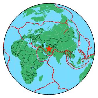
| Region | NORTHEASTERN IRAN |
| Date time | 2017-04-05 06:09:11.7 UTC |
| Location | 35.820 ; 60.474 |
| Depth | 10 km |
| Distance | 94 km ESE of Mashhad, Iran / pop: 2,307,000 / local time: 10:39:11.7 2017-04-05 65 km NNW of Torbat-e Jām, Iran / pop: 58,900 / local time: 10:39:11.7 2017-04-05 |
All data providers for this event:
Geoscience Australia, Canberra, ACT, Australia -- Canberra, Australia (AUST)Seismological Survey of Serbia -- Belgrade, Serbia (BEO)
GeoForschungsZentrum (GFZ) -- Potsdam, Germany (GFZ)
Republican Seismic Survey Center or Azerbaijan National Academy of Sciences -- Baku, Azerbaijan (RSSC)
Instituto Portugues do Mar e da Atmosfera -- Lisbon, Portugal (IPMA)
Bundesanstalt fur Geowissenschaften und Rohstoffe, German Regional Seismograph Network -- Hannover, Germany (BGR)
National Earthquake Information Center, U.S. Geological Survey -- Golden, United States (NEIC)
Disaster and Emergency Management Presidency, Earthquake Department (AFAD) -- Ankara, Turkey (AFAD)
National Center of Meteorology and Seismology -- Abu Dhabi, United Arab Emirates (NCMS)
Institute of Geophysics, University of Tehran -- Tehran, Iran (IGUT)
Instituto Geografico Nacional -- Madrid, Spain (IGN)
National Institute for Earth Physics -- Bucharest, Romania (NIEP)
Korean Meteorological Administration -- Seoul, Korea, Republic of (SEO)
Laboratoire de Detection et de Geophysique -- Bruyeres-le-Chatel, France (LDG)
HUN-REN EPSS Kövesligethy Radó Seismological Observato -- Budapest, Hungary (BUD)
Geophysical Survey of the Russian Academy of Sciences -- Obninsk, Russia (GSRAS)
Kandilli Observatory and Earthquake Research Institute -- Istanbul, Turkey (KOERI)
Instituto Nazionale di Geofisica e Vulcanologia -- Rome, Italy (INGV) -- DOI: https://terremoti.ingv.it/en/iside
Institute of Geophysics and Geology -- Chisinau, Moldova (MOLD)
Further information can be found at:
International Institute for Earthquake Engineering and Seismology -- Tehran, Iran (IIEES)Institute of Geophysics, University of Tehran -- Tehran, Iran (IGUT)
Geophysical Survey of the Russian Academy of Sciences -- Obninsk, Russia (GSRAS)