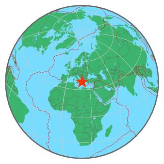
293 km W of Athens, Greece / pop: 730,000 / local time: 23:12:42.6 2017-04-06
116 km W of Pátra, Greece / pop: 164,000 / local time: 23:12:42.6 2017-04-06
20 km N of Argostólion, Greece / pop: 9,900 / local time: 23:12:42.6 2017-04-06
For more information on computation, see the article Bossu et al., 2016:
Thumbnail Based Questionnaires for the Rapid and Efficient Collection of Macroseismic Data from Global Earthquakes, Rémy Bossu, Matthieu Landès, Fréderic Roussel, Robert Steed, Gilles Mazet-Roux, Stacey S. Martin, and Susan Hough. Seismological Research Letter. Oct 2016. doi: 10.1785/0220160120;
Furthermore, to avoid the association with wrong events, we filter testimonies in distance and in intensity depending on the magnitude of the seismic event.
References for tectonic plate boundaries:
Coffin, M.F., Gahagan, L.M., and Lawver, L.A., 1998, Present-day Plate Boundary Digital Data Compilation. University of Texas Institute for Geophysics Technical Report No. 174, pp. 5.
Maps view: Seismicity from the previous 7 days in the area .
Regional instrumental seismicity
This seismicity maps have been generated by concatenating the ISC catalogue (since 1964), the EMSC Euro-Med Bulletin catalogue and the EMSC Real Time catalogue. Therefore, they show the seismicity from 1964 until the earthquake occurrence.
Regional deadly earthquakes from 1500 to origin time
Date
Long.
Lat.
Mag.
Death
Location
1514-04-16
21.0
37.7
6.5
many
SOUTHERN GREECE
1544-04-22
22.6
38.8
6.8
many
GREECE
1566-07-11
21.7
39.0
6.5
many
GREECE
1622-05-05
21.0
37.6
6.6
many
SOUTHERN GREECE
1630-07-22
20.9
38.3
6.9
many
GREECE
1633-11-05
21.0
37.6
6.9
many
SOUTHERN GREECE
1636-09-30
20.7
38.0
7.2
520
GREECE
1658-08-24
20.5
38.3
6.8
320
GREECE
1674-01-01
20.0
39.5
6.5
200
GREECE-ALBANIA BORDER REGION
1701-03-19
19.8
40.2
6.4
300
ALBANIA
1704-11-22
20.7
38.7
6.6
34
GREECE
1723-02-22
20.7
38.6
7.0
many
GREECE
1742-02-14
20.6
37.8
6.5
120
IONIAN SEA
1743-02-20
18.8
39.9
7.3
180
SOUTHERN ITALY
1748-05-25
22.2
38.2
6.8
many
GREECE
1767-07-11
20.3
38.2
7.2
253
GREECE
1783-03-23
20.5
38.6
7.0
35
GREECE
1785-01-30
21.7
38.2
6.6
38
GREECE
1786-02-05
19.9
39.6
6.6
126
GREECE-ALBANIA BORDER REGION
1804-01-08
21.8
38.3
?
many
GREECE
1817-08-23
22.1
38.3
6.8
many
GREECE
1821-01-06
21.2
37.8
6.5
many
SOUTHERN GREECE
1825-01-19
20.7
38.8
6.8
58
GREECE
1846-06-11
22.0
37.0
7.0
28
SOUTHERN GREECE
1851-10-12
19.7
40.7
6.6
2000
ALBANIA
1851-10-17
20.0
40.7
?
400
GREECE-ALBANIA BORDER REGION
1854-07-30
20.2
39.9
6.4
many
GREECE-ALBANIA BORDER REGION
1866-01-02
19.5
40.4
6.5
60
ALBANIA
1867-02-04
20.4
38.2
7.3
224
GREECE
1870-08-01
22.6
38.5
6.8
117
GREECE
1875-04-29
21.3
37.3
5.5
47
SOUTHERN GREECE
1886-08-27
21.5
37.1
7.5
600
SOUTHERN GREECE
1894-04-20
23.0
38.6
6.7
255
GREECE
1894-04-27
23.0
38.7
7.2
255
GREECE
1895-05-14
20.5
39.4
6.6
many
GREECE-ALBANIA BORDER REGION
1909-06-15
22.2
39.1
5.7
36
GREECE
1920-11-26
20.0
40.3
6.3
200
GREECE-ALBANIA BORDER REGION
1930-11-21
19.6
40.2
6.0
35
ALBANIA
1930-12-02
19.6
40.3
5.0
25
ALBANIA
1931-01-28
20.7
40.6
5.9
100
GREECE-ALBANIA BORDER REGION
1953-08-12
20.6
38.3
7.2
800
GREECE
1954-04-30
22.3
39.3
7.0
31
GREECE
1995-06-15
22.3
38.4
6.5
26
GREECE
1999-09-07
23.6
38.1
5.8
143
GREECE
2008-06-08
21.5
38.0
6.4
2
SOUTHERN GREECE
2015-11-17
20.4
38.8
6.5
2
GREECE
Source:
From 1500 to 1999: T. Utsu ; International Handbook of Earthquake and Engineering Seismology; vol. A; 691-718