| Magnitude | 4.7 |
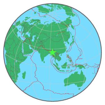
| Region | MYANMAR-INDIA BORDER REGION |
| Date time | 2017-07-02 05:27:44.6 UTC |
| Location | 24.322 ; 94.640 |
| Depth | 80 km |
| Distance | 89 km ESE of Imphāl, India / pop: 223,000 / local time: 10:57:44.6 2017-07-02 74 km ESE of Thoubāl, India / pop: 44,400 / local time: 10:57:44.6 2017-07-02 |
All data providers for this event:
GeoForschungsZentrum (GFZ) -- Potsdam, Germany (GFZ)Geophysical Survey of the Russian Academy of Sciences -- Obninsk, Russia (GSRAS)
National Earthquake Information Center, U.S. Geological Survey -- Golden, United States (NEIC)
India Meteorological Department, New Delhi, India -- New Delhi, India (NDI)
Further information can be found at:
National Earthquake Information Center, U.S. Geological Survey -- Golden, United States (NEIC)India Meteorological Department, New Delhi, India -- New Delhi, India (NDI)
GeoForschungsZentrum (GFZ) -- Potsdam, Germany (GFZ)
Geophysical Survey of the Russian Academy of Sciences -- Obninsk, Russia (GSRAS)