| Magnitude | 6.0 |
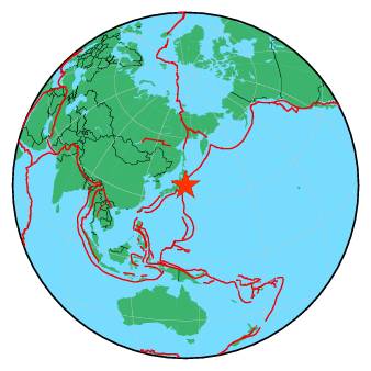
| Region | OFF EAST COAST OF HONSHU, JAPAN |
| Date time | 2017-10-06 07:59:32.7 UTC |
| Location | 37.446 ; 143.977 |
| Depth | 10 km |
| Distance | 277 km ENE of Iwaki, Japan / pop: 357,000 / local time: 16:59:32.7 2017-10-06 258 km ESE of Ishinomaki, Japan / pop: 117,000 / local time: 16:59:32.7 2017-10-06 |
All data providers for this event:
Instituto Geografico Nacional -- Madrid, Spain (IGN)National Institute for Earth Physics -- Bucharest, Romania (NIEP)
Geoscience Australia, Canberra, ACT, Australia -- Canberra, Australia (AUST)
Korean Meteorological Administration -- Seoul, Korea, Republic of (SEO)
Laboratoire de Detection et de Geophysique -- Bruyeres-le-Chatel, France (LDG)
GeoForschungsZentrum (GFZ) -- Potsdam, Germany (GFZ)
HUN-REN EPSS Kövesligethy Radó Seismological Observato -- Budapest, Hungary (BUD)
Republican Seismic Survey Center or Azerbaijan National Academy of Sciences -- Baku, Azerbaijan (RSSC)
Geophysical Survey of the Russian Academy of Sciences -- Obninsk, Russia (GSRAS)
Instituto Portugues do Mar e da Atmosfera -- Lisbon, Portugal (IPMA)
Kandilli Observatory and Earthquake Research Institute -- Istanbul, Türkiye (KOERI)
Instituto Nazionale di Geofisica e Vulcanologia -- Rome, Italy (INGV) -- DOI: https://terremoti.ingv.it/en/iside
National Earthquake Information Center, U.S. Geological Survey -- Golden, United States (NEIC)
Further information can be found at:
GeoForschungsZentrum (GFZ) -- Potsdam, Germany (GFZ)National Earthquake Information Center, U.S. Geological Survey -- Golden, United States (NEIC)
Japan Meteorological Agency Seismic Network -- Tokyo, Japan (JMA)