| Magnitude | 4.0 |
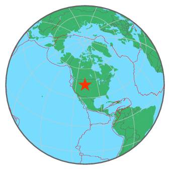
| Region | WYOMING |
| Date time | 2017-11-03 23:11:12.5 UTC |
| Location | 43.520 ; -107.387 |
| Depth | 17 km |
| Distance | 267 km SSE of Billings, United States / pop: 110,000 / local time: 17:11:12.5 2017-11-03 72 km SE of Worland, United States / pop: 5,300 / local time: 17:11:12.5 2017-11-03 |
All data providers for this event:
National Earthquake Information Center, U.S. Geological Survey -- Golden, United States (NEIC)Montana Regional Seismic Network, Montana Bureau of Mines and Geology -- Helena, United States (MB)
Further information can be found at:
GeoForschungsZentrum (GFZ) -- Potsdam, Germany (GFZ)National Earthquake Information Center, U.S. Geological Survey -- Golden, United States (NEIC)