| Magnitude | 2.4 |
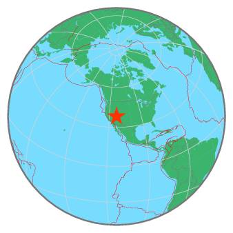
| Region | UTAH |
| Date time | 2019-07-31 05:30:28.0 UTC |
| Location | 38.160 ; -113.119 |
| Depth | 10 km |
| Distance | 263 km SSW of Provo, United States / pop: 115,000 / local time: 23:30:28.0 2019-07-30 28 km S of Milford, United States / pop: 1,300 / local time: 23:30:28.0 2019-07-30 |
All data providers for this event:
National Earthquake Information Center, U.S. Geological Survey -- Golden, United States (NEIC)University of Utah Regional Network, University of Utah Seismograph Stations -- Salt Lake City, United States (UU)
Further information can be found at:
GeoForschungsZentrum (GFZ) -- Potsdam, Germany (GFZ)National Earthquake Information Center, U.S. Geological Survey -- Golden, United States (NEIC)