| Magnitude | 2.1 |
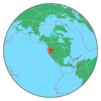
| Region | MOUNT RAINIER AREA, WASHINGTON |
| Date time | 2019-10-29 08:57:49.3 UTC |
| Location | 46.852 ; -121.753 |
| Depth | 1 km |
| Distance | 69 km ESE of Tacoma, United States / pop: 207,000 / local time: 01:57:49.3 2019-10-29 47 km ESE of Graham, United States / pop: 23,400 / local time: 01:57:49.3 2019-10-29 |
All data providers for this event:
Pacific Northwest Regional Seismic Network, University of Washington, Seattle -- Seattle, United States (UW)Further information can be found at:
National Earthquake Information Center, U.S. Geological Survey -- Golden, United States (NEIC)GeoForschungsZentrum (GFZ) -- Potsdam, Germany (GFZ)