| Magnitude | 6.3 |
| Region | OFF COAST OF CHIAPAS, MEXICO |
| Date time | 2019-11-20 04:27:04.9 UTC |
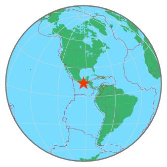
| Location | 13.950 ; -93.158 |
| Depth | 10 km |
| Distance | 144 km SSW of Tapachula, Mexico / pop: 202,000 / local time: 22:27:04.9 2019-11-19 120 km SW of Brisas Barra de Suchiate, Mexico / pop: 13,700 / local time: 22:27:04.9 2019-11-19 |
All data providers for this event:
Centre National de la Recherche Scientifique et Technique -- Rabat, Morocco (CNRST)Instituto Geografico Nacional -- Madrid, Spain (IGN)
Geoscience Australia, Canberra, ACT, Australia -- Canberra, Australia (AUST)
Servicio Sismologico Nacional, Instituto de Geofisica, UNAM -- Mexico City, Mexico (UNM)
GeoForschungsZentrum (GFZ) -- Potsdam, Germany (GFZ)
HUN-REN EPSS Kövesligethy Radó Seismological Observato -- Budapest, Hungary (BUD)
Badan Meteorologi, Klimatologi dan Geofisika -- Jakarta, Indonesia (BMKG)
Geophysical Survey of the Russian Academy of Sciences -- Obninsk, Russia (GSRAS)
Instituto Portugues do Mar e da Atmosfera -- Lisbon, Portugal (IPMA)
Kandilli Observatory and Earthquake Research Institute -- Istanbul, Türkiye (KOERI)
Instituto Nazionale di Geofisica e Vulcanologia -- Rome, Italy (INGV) -- DOI: https://terremoti.ingv.it/en/iside
India Meteorological Department, New Delhi, India -- New Delhi, India (NDI)
National Earthquake Information Center, U.S. Geological Survey -- Golden, United States (NEIC)
Further information can be found at:
Servicio Sismologico Nacional, Instituto de Geofisica, UNAM -- Mexico City, Mexico (UNM)GeoForschungsZentrum (GFZ) -- Potsdam, Germany (GFZ)
National Earthquake Information Center, U.S. Geological Survey -- Golden, United States (NEIC)