| Magnitude | 5.2 |
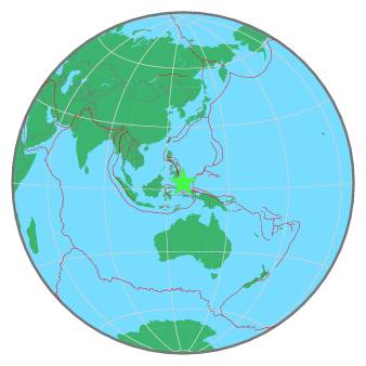
| Region | NORTH OF HALMAHERA, INDONESIA |
| Date time | 2020-02-29 09:28:26.2 UTC |
| Location | 3.162 ; 128.220 |
| Depth | 146 km |
| Distance | 280 km N of Ternate, Indonesia / pop: 101,000 / local time: 18:28:26.2 2020-02-29 161 km N of Tobelo, Indonesia / pop: 10,000 / local time: 18:28:26.2 2020-02-29 |
All data providers for this event:
Philippine Inst. of Volcanology and Seismology, Quezon City, Philippines -- Manila, Philippines (PIVS)National Institute for Earth Physics -- Bucharest, Romania (NIEP)
Geoscience Australia, Canberra, ACT, Australia -- Canberra, Australia (AUST)
GeoForschungsZentrum (GFZ) -- Potsdam, Germany (GFZ)
Republican Seismic Survey Center or Azerbaijan National Academy of Sciences -- Baku, Azerbaijan (RSSC)
Badan Meteorologi, Klimatologi dan Geofisika -- Jakarta, Indonesia (BMKG)
Geophysical Survey of the Russian Academy of Sciences -- Obninsk, Russia (GSRAS)
Kandilli Observatory and Earthquake Research Institute -- Istanbul, Türkiye (KOERI)
National Earthquake Information Center, U.S. Geological Survey -- Golden, United States (NEIC)
Further information can be found at:
Philippine Inst. of Volcanology and Seismology, Quezon City, Philippines -- Manila, Philippines (PIVS)National Earthquake Information Center, U.S. Geological Survey -- Golden, United States (NEIC)
Badan Meteorologi, Klimatologi dan Geofisika -- Jakarta, Indonesia (BMKG)
GeoForschungsZentrum (GFZ) -- Potsdam, Germany (GFZ)