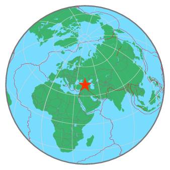
235 km W of Tbilisi, Georgia / pop: 1,050,000 / local time: 17:18:43.7 2020-04-29
35 km NE of Artvin, Turkey / pop: 24,300 / local time: 16:18:43.7 2020-04-29
25 km SW of Akhaldaba, Georgia / pop: 3,700 / local time: 17:18:43.7 2020-04-29
For more information on computation, see the article Bossu et al., 2016:
Thumbnail Based Questionnaires for the Rapid and Efficient Collection of Macroseismic Data from Global Earthquakes, Rémy Bossu, Matthieu Landès, Fréderic Roussel, Robert Steed, Gilles Mazet-Roux, Stacey S. Martin, and Susan Hough. Seismological Research Letter. Oct 2016. doi: 10.1785/0220160120;
Furthermore, to avoid the association with wrong events, we filter testimonies in distance and in intensity depending on the magnitude of the seismic event.
References for tectonic plate boundaries:
Coffin, M.F., Gahagan, L.M., and Lawver, L.A., 1998, Present-day Plate Boundary Digital Data Compilation. University of Texas Institute for Geophysics Technical Report No. 174, pp. 5.
Maps view: Seismicity from the previous 7 days in the area .
Regional instrumental seismicity
This seismicity maps have been generated by concatenating the ISC catalogue (since 1964), the EMSC Euro-Med Bulletin catalogue and the EMSC Real Time catalogue. Therefore, they show the seismicity from 1964 until the earthquake occurrence.
Regional deadly earthquakes from 1500 to origin time
Date
Long.
Lat.
Mag.
Death
Location
1458-04-00
40.4
39.9
7.6
32000
EASTERN TURKEY
1458-11-08
40.4
39.9
?
100
EASTERN TURKEY
1481-03-00
40.4
39.9
7.7
3000
EASTERN TURKEY
1482-00-00
40.4
39.9
?
30000
EASTERN TURKEY
1660-00-00
41.3
40.0
6.5
1500
EASTERN TURKEY
1679-06-04
44.7
40.2
6.4
7600
ARMENIA
1707-00-00
43.0
40.4
?
1000s
TURKEY-ARMENIA BORDER REGION
1784-07-18
39.5
39.7
7.6
5000
EASTERN TURKEY
1840-07-02
43.9
39.5
7.4
1000
EASTERN TURKEY
1840-07-15
43.0
39.5
?
many
EASTERN TURKEY
1859-05-21
41.5
40.0
?
500
EASTERN TURKEY
1859-06-02
41.0
40.0
6.4
2000
EASTERN TURKEY
1888-09-22
43.3
41.3
6.1
many
GEORGIA-TURKEY BORDER REGION
1891-04-03
42.5
39.1
5.5
100
EASTERN TURKEY
1899-12-31
43.6
41.6
6.3
248
GEORGIA-TURKEY BORDER REGION
1900-07-12
43.1
40.3
5.9
140
TURKEY-ARMENIA BORDER REGION
1903-04-28
42.7
39.1
7.0
3560
EASTERN TURKEY
1903-05-28
42.8
40.9
5.4
1000
EASTERN TURKEY
1920-02-20
44.0
41.9
6.2
130
GEORGIA-ARMENIA BORDER REGION
1924-05-13
42.0
40.0
5.3
50
EASTERN TURKEY
1924-09-13
42.1
40.0
6.8
30
EASTERN TURKEY
1924-09-20
41.3
40.0
?
60
EASTERN TURKEY
1924-12-19
39.7
41.0
?
210
EASTERN TURKEY
1925-01-09
42.8
41.2
5.8
200
GEORGIA-TURKEY BORDER REGION
1925-02-08
42.7
41.8
5.5
140
GEORGIA-TURKEY BORDER REGION
1926-10-22
43.7
40.7
5.7
370
TURKEY-ARMENIA BORDER REGION
1935-05-01
43.7
40.6
6.2
500
TURKEY-ARMENIA BORDER REGION
1941-09-10
43.0
39.5
6.0
500
EASTERN TURKEY
1946-05-31
41.5
40.0
6.0
1300
EASTERN TURKEY
1949-08-17
40.9
39.4
6.7
320
EASTERN TURKEY
1952-01-03
41.7
39.9
6.0
103
EASTERN TURKEY
1952-06-03
39.5
39.8
?
94
EASTERN TURKEY
1966-08-19
41.6
39.2
6.8
2517
EASTERN TURKEY
1966-08-20
40.9
39.3
5.4
25
EASTERN TURKEY
1967-07-26
40.4
39.5
6.0
110
EASTERN TURKEY
1983-10-30
42.2
40.3
6.9
1400
EASTERN TURKEY
1988-12-07
44.2
41.0
6.8
25000
GEORGIA-ARMENIA BORDER REGION
1991-04-29
43.7
42.5
7.0
184
RUSSIA-GEORGIA BORDER REGION
1992-03-13
39.6
39.7
6.8
652
EASTERN TURKEY
2002-04-25
44.9
41.8
4.8
5
GEORGIA (SAK'ART'VELO)
2003-01-27
39.9
39.5
6.0
1
EASTERN TURKEY
2004-03-25
40.7
39.8
5.6
10
EASTERN TURKEY
2004-07-01
43.9
39.7
5.1
18
EASTERN TURKEY
2004-07-30
43.9
39.7
4.8
1
EASTERN TURKEY
Source:
From 1500 to 1999: T. Utsu ; International Handbook of Earthquake and Engineering Seismology; vol. A; 691-718