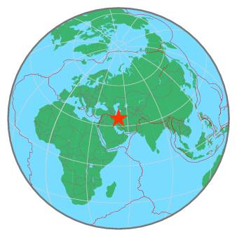
56 km E of Tehrān, Iran, Islamic Republic of / pop: 7,154,000 / local time: 13:41:37.6 2020-05-27
8 km NW of Damāvand, Iran, Islamic Republic of / pop: 29,200 / local time: 13:41:37.6 2020-05-27
For more information on computation, see the article Bossu et al., 2016:
Thumbnail Based Questionnaires for the Rapid and Efficient Collection of Macroseismic Data from Global Earthquakes, Rémy Bossu, Matthieu Landès, Fréderic Roussel, Robert Steed, Gilles Mazet-Roux, Stacey S. Martin, and Susan Hough. Seismological Research Letter. Oct 2016. doi: 10.1785/0220160120;
Furthermore, to avoid the association with wrong events, we filter testimonies in distance and in intensity depending on the magnitude of the seismic event.
References for tectonic plate boundaries:
Coffin, M.F., Gahagan, L.M., and Lawver, L.A., 1998, Present-day Plate Boundary Digital Data Compilation. University of Texas Institute for Geophysics Technical Report No. 174, pp. 5.
Maps view: Seismicity from the previous 7 days in the area .
Regional instrumental seismicity
This seismicity maps have been generated by concatenating the ISC catalogue (since 1964), the EMSC Euro-Med Bulletin catalogue and the EMSC Real Time catalogue. Therefore, they show the seismicity from 1964 until the earthquake occurrence.
Regional deadly earthquakes from 1500 to origin time
Date
Long.
Lat.
Mag.
Death
Location
1485-08-15
50.5
36.4
7.2
many
NORTHERN IRAN
1574-00-00
51.4
34.0
?
1200
CENTRAL IRAN
1608-04-20
50.5
36.4
7.4
many
NORTHERN IRAN
1665-06-15
52.1
35.7
6.5
many
NORTHERN IRAN
1755-06-07
51.4
34.0
5.9
1200
CENTRAL IRAN
1778-12-15
51.4
34.0
6.2
8000
CENTRAL IRAN
1823-09-07
53.3
36.3
?
many
NORTHERN IRAN
1825-00-00
52.5
36.1
6.7
many
NORTHERN IRAN
1830-03-27
52.3
35.7
7.1
530
NORTHERN IRAN
1830-05-09
52.1
35.7
?
500
NORTHERN IRAN
1844-05-12
51.4
33.6
6.4
1500
CENTRAL IRAN
1890-07-11
54.6
36.6
7.2
100s
NORTHERN IRAN
1935-03-05
53.1
35.9
6.0
60
NORTHERN IRAN
1935-04-11
53.6
36.5
6.4
500
NORTHERN IRAN
1953-02-12
55.0
35.4
6.3
973
NORTHERN IRAN
1957-07-02
52.7
36.1
7.1
1200
NORTHERN IRAN
1958-01-16
53.0
36.5
?
many
NORTHERN IRAN
1962-09-01
49.9
35.6
7.2
12225
WESTERN IRAN
1980-12-19
50.7
34.6
6.1
26
CENTRAL IRAN
1983-03-25
52.3
36.0
4.9
30
NORTHERN IRAN
1990-06-20
49.4
37.0
7.7
35000
NEAR THE COAST OF NORTHERN IRAN
2002-06-22
49.0
35.6
6.5
227
WESTERN IRAN
2004-05-28
51.6
36.2
6.3
35
NORTHERN IRAN
2010-08-27
54.5
35.5
5.7
3
NORTHERN IRAN
2017-12-20
51.0
35.7
4.9
2
NORTHERN IRAN
2017-12-26
50.9
35.7
3.9
1
NORTHERN IRAN
2020-05-07
52.0
35.8
4.6
2
NORTHERN IRAN
Source:
From 1500 to 1999: T. Utsu ; International Handbook of Earthquake and Engineering Seismology; vol. A; 691-718