| Magnitude | 5.4 |
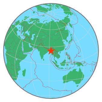
| Region | MYANMAR-INDIA BORDER REGION |
| Date time | 2020-08-27 12:07:15.5 UTC |
| Location | 23.204 ; 93.424 |
| Depth | 10 km |
| Distance | 93 km ESE of Aizawl, India / pop: 265,000 / local time: 17:37:15.5 2020-08-27 41 km NW of Falam, Myanmar / pop: 5,400 / local time: 18:37:15.5 2020-08-27 |
All data providers for this event:
Geoscience Australia, Canberra, ACT, Australia -- Canberra, Australia (AUST)National Institute for Earth Physics -- Bucharest, Romania (NIEP)
GeoForschungsZentrum (GFZ) -- Potsdam, Germany (GFZ)
Red Sismica Nacional de Colombia, INGEOMINAS, Bogota, Colombia -- Bogota, Colombia (RSNC)
HUN-REN EPSS Kövesligethy Radó Seismological Observato -- Budapest, Hungary (BUD)
Republican Seismic Survey Center or Azerbaijan National Academy of Sciences -- Baku, Azerbaijan (RSSC)
Badan Meteorologi, Klimatologi dan Geofisika -- Jakarta, Indonesia (BMKG)
Geophysical Survey of the Russian Academy of Sciences -- Obninsk, Russia (GSRAS)
Instituto Portugues do Mar e da Atmosfera -- Lisbon, Portugal (IPMA)
Kandilli Observatory and Earthquake Research Institute -- Istanbul, Türkiye (KOERI)
National Earthquake Information Center, U.S. Geological Survey -- Golden, United States (NEIC)
India Meteorological Department, New Delhi, India -- New Delhi, India (NDI)
Further information can be found at:
National Earthquake Information Center, U.S. Geological Survey -- Golden, United States (NEIC)GeoForschungsZentrum (GFZ) -- Potsdam, Germany (GFZ)
India Meteorological Department, New Delhi, India -- New Delhi, India (NDI)