| Magnitude | 5.3 |
| Region | GUATEMALA |
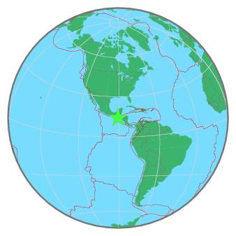
| Date time | 2020-09-27 09:40:55.5 UTC |
| Location | 14.198 ; -90.827 |
| Depth | 101 km |
| Distance | 44 km SSW of Petapa, Guatemala / pop: 141,000 / local time: 03:40:55.5 2020-09-27 12 km S of Escuintla, Guatemala / pop: 103,000 / local time: 03:40:55.5 2020-09-27 |
All data providers for this event:
Geoscience Australia, Canberra, ACT, Australia -- Canberra, Australia (AUST)GeoForschungsZentrum (GFZ) -- Potsdam, Germany (GFZ)
Badan Meteorologi, Klimatologi dan Geofisika -- Jakarta, Indonesia (BMKG)
Geophysical Survey of the Russian Academy of Sciences -- Obninsk, Russia (GSRAS)
Instituto Portugues do Mar e da Atmosfera -- Lisbon, Portugal (IPMA)
Kandilli Observatory and Earthquake Research Institute -- Istanbul, Türkiye (KOERI)
National Earthquake Information Center, U.S. Geological Survey -- Golden, United States (NEIC)
Further information can be found at:
Servicio Sismologico Nacional, Instituto de Geofisica, UNAM -- Mexico City, Mexico (UNM)GeoForschungsZentrum (GFZ) -- Potsdam, Germany (GFZ)
National Earthquake Information Center, U.S. Geological Survey -- Golden, United States (NEIC)