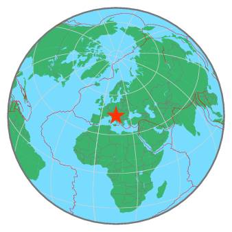
tempDisclaimer
M 4.6 - CROATIA - 2020-11-01 13:15:42 UTC
I felt this earthquake
Summary | Maps | Testimonies | Pictures | List of data providers | Scientific data |
| ![]() |
More information at: |
Earthquake View | Interactive Maps View | I felt this earthquake | Contribution Map |
Seismicity | Regional Moment tensors | Quick MT solutions | PGA/PGV/Population |
Int_Dist | Dist_Time | Donut |
No enough data for Intensity/Distance curve
For more information on computation, see the article Bossu et al., 2016:
- Thumbnail Based Questionnaires for the Rapid and Efficient Collection of Macroseismic Data from Global Earthquakes, Rémy Bossu, Matthieu Landès, Fréderic Roussel, Robert Steed, Gilles Mazet-Roux, Stacey S. Martin, and Susan Hough. Seismological Research Letter. Oct 2016. doi: 10.1785/0220160120;
- Furthermore, to avoid the association with wrong events, we filter testimonies in distance and in intensity depending on the magnitude of the seismic event.
T0+Notification |
![]() |
T0+30min |
![]() |
Global view | Regional view | Local view |
References for tectonic plate boundaries:
Coffin, M.F., Gahagan, L.M., and Lawver, L.A., 1998, Present-day Plate Boundary Digital Data Compilation. University of Texas Institute for Geophysics Technical Report No. 174, pp. 5.
Maps view: Seismicity from the previous 7 days in the area |
This seismicity maps have been generated by concatenating the ISC catalogue (since 1964), the EMSC Euro-Med Bulletin catalogue and the EMSC Real Time catalogue. Therefore, they show the seismicity from 1964 until the earthquake occurrence.
Date | Long. | Lat. | Mag. | Death | Location |
1461-11-27 | 13.6 | 42.3 | 6.3 | 100 | CENTRAL ITALY |
1511-03-26 | 13.4 | 46.2 | 6.9 | many | AUSTRIA-ITALY-SLOVENIA BORDER RG |
1584-09-10 | 12.0 | 43.9 | 5.8 | 196 | CENTRAL ITALY |
1590-09-05 | 16.3 | 45.9 | ? | many | CROATIA REGION |
1624-03-18 | 11.9 | 44.7 | 5.4 | 50 | NORTHERN ITALY |
1627-07-30 | 15.4 | 41.7 | 6.8 | 5000 | SOUTHERN ITALY |
1639-10-08 | 13.3 | 42.6 | 5.5 | 500 | CENTRAL ITALY |
1661-03-22 | 11.9 | 44.0 | 6.8 | 400 | NORTHERN ITALY |
1667-04-06 | 18.1 | 42.6 | 7.2 | 5000 | CROATIA-BOSNIA-MONTENEGRO REGION |
1672-04-14 | 12.6 | 43.9 | 5.7 | 200 | CENTRAL ITALY |
1688-04-11 | 13.0 | 44.4 | 5.8 | 50 | ADRIATIC SEA |
1703-01-14 | 13.1 | 42.7 | 6.7 | 9761 | CENTRAL ITALY |
1703-02-02 | 13.3 | 42.4 | 6.7 | many | CENTRAL ITALY |
1706-11-03 | 14.1 | 42.1 | 6.7 | 2400 | CENTRAL ITALY |
1730-05-12 | 13.1 | 42.8 | 6.0 | 500 | CENTRAL ITALY |
1750-12-17 | 14.2 | 45.2 | ? | many | SLOVENIA-CROATIA BORDER REGION |
1768-10-19 | 11.9 | 43.9 | 5.8 | 54 | CENTRAL ITALY |
1781-04-04 | 11.8 | 44.3 | 5.8 | 26 | NORTHERN ITALY |
1781-06-03 | 12.6 | 43.6 | 6.2 | 300 | CENTRAL ITALY |
1781-07-17 | 12.0 | 44.3 | 5.6 | 26 | NORTHERN ITALY |
1786-12-25 | 12.6 | 44.0 | 5.7 | 40 | NORTHERN ITALY |
1788-10-20 | 13.0 | 46.4 | 5.1 | 30 | AUSTRIA-ITALY-SLOVENIA BORDER RG |
1789-09-30 | 12.2 | 43.5 | 5.8 | 500 | CENTRAL ITALY |
1799-07-28 | 13.2 | 43.2 | 5.8 | 104 | CENTRAL ITALY |
1823-10-00 | 18.2 | 42.7 | ? | many | CROATIA-BOSNIA-MONTENEGRO REGION |
1859-08-22 | 13.1 | 42.8 | 5.7 | 101 | CENTRAL ITALY |
1898-07-02 | 16.7 | 43.6 | ? | many | CROATIA REGION |
1915-01-13 | 13.7 | 42.0 | 7.0 | 32610 | CENTRAL ITALY |
1927-02-14 | 18.0 | 43.0 | 6.1 | 50 | BOSNIA AND HERZEGOVINA REGION |
1943-10-03 | 13.7 | 42.9 | 5.9 | 25 | CENTRAL ITALY |
1976-05-06 | 13.3 | 46.3 | 6.1 | 965 | AUSTRIA-ITALY-SLOVENIA BORDER RG |
2002-10-31 | 14.9 | 41.7 | 5.7 | 29 | SOUTHERN ITALY |
2004-07-12 | 13.6 | 46.3 | 5.2 | 1 | SLOVENIA |
2009-04-06 | 13.3 | 42.4 | 6.3 | 309 | CENTRAL ITALY |
2009-04-07 | 13.4 | 42.3 | 5.6 | 1 | CENTRAL ITALY |
2015-02-21 | 18.9 | 44.5 | 3.7 | 4 | BOSNIA AND HERZEGOVINA |
2016-08-24 | 13.2 | 42.7 | 6.2 | 299 | CENTRAL ITALY |
2016-10-26 | 13.1 | 42.9 | 6.1 | 1 | CENTRAL ITALY |
2016-10-30 | 13.1 | 42.8 | 6.5 | 2 | CENTRAL ITALY |
2017-01-18 | 13.3 | 42.5 | 5.7 | 34 | CENTRAL ITALY |
2020-03-22 | 16.0 | 45.9 | 5.4 | 1 | CROATIA |
Source:
- From 1500 to 1999: T. Utsu ; International Handbook of Earthquake and Engineering Seismology; vol. A; 691-718
- From 2000 to 2007: USGS Quality composite earthquake catalog
- From 2008: National Centers for Environmental Information (NOAA)
MapGraphsClustering


