| Magnitude | 2.7 |
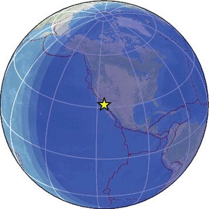
| Region | BAJA CALIFORNIA, MEXICO |
| Date time | 2026-01-28 05:42:46.9 UTC |
| Location | 31.513 ; -115.613 |
| Depth | 10 km |
| Distance | 102 km ESE of Ensenada, Mexico / pop: 279,000 / local time: 21:42:46.9 2026-01-27 64 km ENE of San Vicente, Mexico / pop: 4,300 / local time: 21:42:46.9 2026-01-27 |
Source parameters provided by:
National Earthquake Information Center, U.S. Geological Survey -- Golden, United States (NEIC)
All data providers for this event:
Southern California Seismic Network, California Institute of Technology / USGS - Pasadena -- Pasadena, United States (SCSN)National Earthquake Information Center, U.S. Geological Survey -- Golden, United States (NEIC)
Further information can be found at:
GeoForschungsZentrum (GFZ) -- Potsdam, Germany (GFZ)Servicio Sismologico Nacional, Instituto de Geofisica, UNAM -- Mexico City, Mexico (UNM)
National Earthquake Information Center, U.S. Geological Survey -- Golden, United States (NEIC)