| Magnitude | 4.2 |
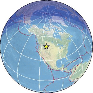
| Region | WESTERN MONTANA |
| Date time | 2026-01-29 19:41:10.4 UTC |
| Location | 47.624 ; -111.203 |
| Depth | 21 km |
| Distance | 290 km WNW of Billings, United States / pop: 110,000 / local time: 12:41:10.4 2026-01-29 16 km NNE of Great Falls, United States / pop: 59,600 / local time: 12:41:10.4 2026-01-29 |
Source parameters reviewed by a seismologist
All data providers for this event:
Canadian National Seismic Network (CNSN) BB stations -- Ottawa, Canada (CN)GeoForschungsZentrum (GFZ) -- Potsdam, Germany (GFZ)
National Earthquake Information Center, U.S. Geological Survey -- Golden, United States (NEIC)
University of Utah Regional Network, University of Utah Seismograph Stations -- Salt Lake City, United States (UU)
Further information can be found at:
National Earthquake Information Center, U.S. Geological Survey -- Golden, United States (NEIC)GeoForschungsZentrum (GFZ) -- Potsdam, Germany (GFZ)