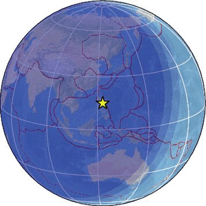
| Magnitude | 3.9 |
| Region | PHILIPPINE ISLANDS REGION |
| Date time | 2026-01-30 18:30:27.7 UTC |
| Location | 15.055 ; 122.982 |
| Depth | 10 km |
| Distance | 161 km NNW of Naga, Philippines / pop: 174,000 / local time: 02:30:27.7 2026-01-31 75 km NE of Casuguran, Philippines / pop: 2,200 / local time: 02:30:27.7 2026-01-31 |
Source parameters provided by:
National Earthquake Information Center, U.S. Geological Survey -- Golden, United States (NEIC)
All data providers for this event:
National Earthquake Information Center, U.S. Geological Survey -- Golden, United States (NEIC)Philippine Inst. of Volcanology and Seismology, Quezon City, Philippines -- Manila, Philippines (PIVS)
Further information can be found at:
Philippine Inst. of Volcanology and Seismology, Quezon City, Philippines -- Manila, Philippines (PIVS)National Earthquake Information Center, U.S. Geological Survey -- Golden, United States (NEIC)
GeoForschungsZentrum (GFZ) -- Potsdam, Germany (GFZ)