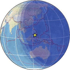
| Magnitude | 3.9 |
| Region | MORO GULF, MINDANAO, PHILIPPINES |
| Date time | 2026-01-31 12:10:05.5 UTC |
| Location | 6.150 ; 123.742 |
| Depth | 10 km |
| Distance | 128 km WSW of Koronadal, Philippines / pop: 125,000 / local time: 20:10:05.5 2026-01-31 56 km SSW of Kalamansig, Philippines / pop: 12,800 / local time: 20:10:05.5 2026-01-31 |
Source parameters provided by:
National Earthquake Information Center, U.S. Geological Survey -- Golden, United States (NEIC)
All data providers for this event:
National Earthquake Information Center, U.S. Geological Survey -- Golden, United States (NEIC)Philippine Inst. of Volcanology and Seismology, Quezon City, Philippines -- Manila, Philippines (PIVS)
Further information can be found at:
Philippine Inst. of Volcanology and Seismology, Quezon City, Philippines -- Manila, Philippines (PIVS)GeoForschungsZentrum (GFZ) -- Potsdam, Germany (GFZ)
Badan Meteorologi, Klimatologi dan Geofisika -- Jakarta, Indonesia (BMKG)
National Earthquake Information Center, U.S. Geological Survey -- Golden, United States (NEIC)