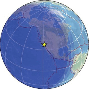
| Magnitude | 2.4 |
| Region | CENTRAL CALIFORNIA |
| Date time | 2026-02-02 10:59:32.1 UTC |
| Location | 36.827 ; -118.088 |
| Depth | 1 km |
| Distance | 121 km NE of Visalia, United States / pop: 130,000 / local time: 02:59:32.1 2026-02-02 25 km NNW of Lone Pine, United States / pop: 2,000 / local time: 02:59:32.1 2026-02-02 |
Source parameters provided by:
Western Great Basin/Eastern Sierra Nevada, University of Nevada, Reno -- Reno, United States (NN)
All data providers for this event:
Western Great Basin/Eastern Sierra Nevada, University of Nevada, Reno -- Reno, United States (NN)Further information can be found at:
GeoForschungsZentrum (GFZ) -- Potsdam, Germany (GFZ)National Earthquake Information Center, U.S. Geological Survey -- Golden, United States (NEIC)