| Magnitude | 4.1 |
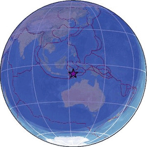
| Region | BANDA SEA |
| Date time | 2026-02-04 16:38:24.8 UTC |
| Location | -7.626 ; 123.955 |
| Depth | 272 km |
| Distance | 206 km WNW of Dili, Timor Leste / pop: 150,000 / local time: 01:38:24.8 2026-02-05 176 km WNW of Maubara, Timor Leste / pop: 16,300 / local time: 01:38:24.8 2026-02-05 |
Source parameters reviewed by a seismologist
All data providers for this event:
Badan Meteorologi, Klimatologi dan Geofisika -- Jakarta, Indonesia (BMKG)GeoForschungsZentrum (GFZ) -- Potsdam, Germany (GFZ)
National Earthquake Information Center, U.S. Geological Survey -- Golden, United States (NEIC)
Further information can be found at:
GeoForschungsZentrum (GFZ) -- Potsdam, Germany (GFZ)Badan Meteorologi, Klimatologi dan Geofisika -- Jakarta, Indonesia (BMKG)
National Earthquake Information Center, U.S. Geological Survey -- Golden, United States (NEIC)