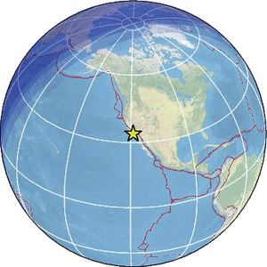
| Magnitude | 2.0 |
| Region | CHANNEL ISLANDS REG., CALIFORNIA |
| Date time | 2026-02-06 18:44:12.8 UTC |
| Location | 33.780 ; -118.796 |
| Depth | 6 km |
| Distance | 43 km WSW of Torrance, United States / pop: 143,000 / local time: 10:44:12.8 2026-02-06 27 km S of Malibu, United States / pop: 12,900 / local time: 10:44:12.8 2026-02-06 |
Source parameters provided by:
Southern California Seismic Network, California Institute of Technology / USGS - Pasadena -- Pasadena, United States (SCSN)
All data providers for this event:
Southern California Seismic Network, California Institute of Technology / USGS - Pasadena -- Pasadena, United States (SCSN)Further information can be found at:
GeoForschungsZentrum (GFZ) -- Potsdam, Germany (GFZ)National Earthquake Information Center, U.S. Geological Survey -- Golden, United States (NEIC)