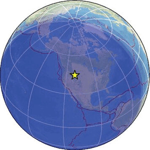
| Magnitude | 2.2 |
| Region | YELLOWSTONE NAT. PARK, MONTANA |
| Date time | 2026-02-07 08:29:24.2 UTC |
| Location | 44.748 ; -111.087 |
| Depth | 11 km |
| Distance | 233 km SW of Billings, United States / pop: 110,000 / local time: 01:29:24.2 2026-02-07 10 km N of West Yellowstone, United States / pop: 1,300 / local time: 01:29:24.2 2026-02-07 |
Source parameters provided by:
University of Utah Regional Network, University of Utah Seismograph Stations -- Salt Lake City, United States (UU)
All data providers for this event:
University of Utah Regional Network, University of Utah Seismograph Stations -- Salt Lake City, United States (UU)Further information can be found at:
GeoForschungsZentrum (GFZ) -- Potsdam, Germany (GFZ)National Earthquake Information Center, U.S. Geological Survey -- Golden, United States (NEIC)