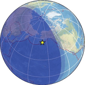
| Magnitude | 2.9 |
| Region | SOUTH OF ALASKA |
| Date time | 2026-02-17 14:26:43.3 UTC |
| Location | 54.384 ; -159.839 |
| Depth | 35 km |
| Distance | 959 km SSW of Anchorage, United States / pop: 298,000 / local time: 05:26:43.3 2026-02-17 114 km SSE of Sand Point, United States / pop: 1,000 / local time: 05:26:43.3 2026-02-17 |
Source parameters provided by:
National Earthquake Information Center, U.S. Geological Survey -- Golden, United States (NEIC)
All data providers for this event:
Alaska Regional Network, University of Alaska-Fairbanks -- Fairbanks, United States (AK)National Earthquake Information Center, U.S. Geological Survey -- Golden, United States (NEIC)
Further information can be found at:
National Earthquake Information Center, U.S. Geological Survey -- Golden, United States (NEIC)GeoForschungsZentrum (GFZ) -- Potsdam, Germany (GFZ)