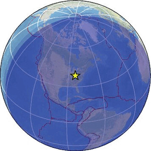
| Magnitude | 2.2 |
| Region | EASTERN KENTUCKY |
| Date time | 2026-02-20 05:02:53.7 UTC |
| Location | 38.572 ; -83.392 |
| Depth | 10 km |
| Distance | 62 km W of Meads, United States / pop: 288,000 / local time: 00:02:53.7 2026-02-20 7 km SW of Vanceburg, United States / pop: 1,400 / local time: 00:02:53.7 2026-02-20 |
Source parameters provided by:
Southeastern Appalachian Cooperative Seismic Network, Virginia Tech, University of Memphis, Tennessee Valley Authority, and University of North Carolina -- Memphis, United States (SE)
All data providers for this event:
Southeastern Appalachian Cooperative Seismic Network, Virginia Tech, University of Memphis, Tennessee Valley Authority, and University of North Carolina -- Memphis, United States (SE)Further information can be found at:
GeoForschungsZentrum (GFZ) -- Potsdam, Germany (GFZ)National Earthquake Information Center, U.S. Geological Survey -- Golden, United States (NEIC)