| Magnitude | 2.1 |
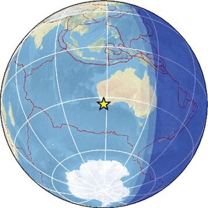
| Region | WESTERN AUSTRALIA |
| Date time | 2026-02-21 09:11:03.9 UTC |
| Location | -33.836 ; 117.921 |
| Depth | 5 km |
| Distance | 268 km ESE of Rockingham, Australia / pop: 108,000 / local time: 17:11:03.9 2026-02-21 37 km ESE of Katanning, Australia / pop: 3,600 / local time: 17:11:03.9 2026-02-21 |
Source parameters provided by:
Geoscience Australia, Canberra, ACT, Australia -- Canberra, Australia (AUST)
All data providers for this event:
Geoscience Australia, Canberra, ACT, Australia -- Canberra, Australia (AUST)Further information can be found at:
GeoForschungsZentrum (GFZ) -- Potsdam, Germany (GFZ)National Earthquake Information Center, U.S. Geological Survey -- Golden, United States (NEIC)
Geoscience Australia, Canberra, ACT, Australia -- Canberra, Australia (AUST)