| Magnitude | 2.7 |
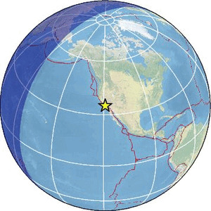
| Region | CENTRAL CALIFORNIA |
| Date time | 2026-03-29 17:25:00.0 UTC |
| Location | 34.917 ; -119.020 |
| Depth | 8 km |
| Distance | 51 km S of Bakersfield, United States / pop: 373,000 / local time: 10:25:00.0 2026-03-29 12 km NW of Frazier Park, United States / pop: 2,600 / local time: 10:25:00.0 2026-03-29 |
Source parameters provided by:
Southern California Seismic Network, California Institute of Technology / USGS - Pasadena -- Pasadena, United States (SCSN)
All data providers for this event:
Southern California Seismic Network, California Institute of Technology / USGS - Pasadena -- Pasadena, United States (SCSN)National Earthquake Information Center, U.S. Geological Survey -- Golden, United States (NEIC)
Further information can be found at:
National Earthquake Information Center, U.S. Geological Survey -- Golden, United States (NEIC)GeoForschungsZentrum (GFZ) -- Potsdam, Germany (GFZ)