| Magnitude | 4.2 |
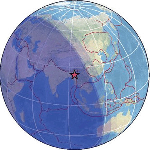
| Region | MYANMAR-INDIA BORDER REGION |
| Date time | 2026-04-25 21:27:21.0 UTC |
| Location | 24.113 ; 94.550 |
| Depth | 90 km |
| Distance | 99 km SE of Imphāl, India / pop: 223,000 / local time: 02:57:21.0 2026-04-26 54 km N of Mawlaik, Myanmar / pop: 44,500 / local time: 03:57:21.0 2026-04-26 |
Source parameters provided by:
India Meteorological Department, New Delhi, India -- New Delhi, India (NDI)
All data providers for this event:
India Meteorological Department, New Delhi, India -- New Delhi, India (NDI)Further information can be found at:
National Earthquake Information Center, U.S. Geological Survey -- Golden, United States (NEIC)India Meteorological Department, New Delhi, India -- New Delhi, India (NDI)
GeoForschungsZentrum (GFZ) -- Potsdam, Germany (GFZ)