| Magnitude | 4.0 |
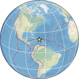
| Region | DOMINICAN REPUBLIC REGION |
| Date time | 2026-07-14 15:20:13.5 UTC |
| Location | 19.599 ; -69.405 |
| Depth | 15 km |
| Distance | 95 km ENE of San Francisco de Macorís, Dominican Republic / pop: 124,000 / local time: 11:20:13.5 2026-07-14 45 km NNW of Samaná, Dominican Republic / pop: 11,400 / local time: 11:20:13.5 2026-07-14 |
Source parameters reviewed by a seismologist
All data providers for this event:
URGeo, Geoazur (Universite Cote d'Azur, IRD, CNRS, Observatoire de la Cote d'Azur) -- Port-au-Prince, Haiti (AYIT)National Earthquake Information Center, U.S. Geological Survey -- Golden, United States (NEIC)
Further information can be found at:
GeoForschungsZentrum (GFZ) -- Potsdam, Germany (GFZ)National Earthquake Information Center, U.S. Geological Survey -- Golden, United States (NEIC)
Universidad Autonoma de Santo Domingo -- Santo Domingo, Dominican Republic (UASD)